Monday, November 18, 2013

A Last Look at Fall Season – 2013


It’s Sunday…and it’s gray and rainy!  The good news is that it’s in the mid-60s!  The Fall colors…and the season itself seemed to come and go so fast this year…

So… I thought that I’d share a few late season photos just to mark our passage into 'that next season'.  Hopefully, we won’t have a terribly cold winter and, more importantly, we have our fingers crossed that we won’t see much snow!
 
As you can see, J.D. decided to get up on the computer desk to give me a hand, (really, a paw), with this blog.
 

Apparently I wasn’t paying enough attention to him, so he decided that he’d roll over so that he blocked the keyboard and I’d have to pet him… He really has us very well trained!

This is a view up our street… We’re surrounded by trees.

Laurie took this photo of the property next to ours… A deer trail runs through it and our many hickory and oak trees provide a lot of food for deer, turkey and squirrels.

Here’s a photo of our woods from our deck. We love the golden colors that ‘pop’ in the sunshine!

The other day, some local residents came down the road looking for food…and Laurie grabbed this photo from our front porch.  The area supports a very large flock of turkey that cruises through the woods looking for sustenance. (A flock of turkey is also known as a ‘rafter’ or a ‘gang’)

Laurie and a group of her lady friends recently went on a charity home tour at Wind River, an upscale development along Tellico Lake and she captured some very nice pictures of late Fall in East Tennessee.


Love the colors…

This is the golf course at Wind River across the lake from us.   We’ve never played on this ‘links style’ golf course but we want to someday. 

Well, back to reality!  I guess that I’ll pay bills or do something else that needs to be done.  Besides, J.D. decided to leave, probably because I wasn’t paying any attention to him…
Just click on any of the photos to enlarge them…
Thanks for stopping by for a visit!
Take Care, Big Daddy Dave 

Sunday, November 17, 2013

Athabasca Falls – Twenty Miles to Jasper Alberta

We continued north on Highway 93 in Jasper National Park… This park is the largest national park in the Canadian Rockies, covering 4,200 square miles.  The park includes the glaciers of the Columbia Icefield, hot springs, lakes, waterfalls and mountains. Wildlife in the park includes elk, caribou, moose, mule deer, white-tailed deer, mountain goats, bighorn sheep, grizzly bears, black bears, coyotes, beavers, Rocky Mountain pikas, hoary marmots, grey wolves, mountain lions, and wolverines.


This is the first of many photos we took of the Athabasca Falls on the upper Athabasca River.  This river flows from the Columbia Glacier of the Columbia Icefield.  In Woods Cree, the word ‘aðapaskāw’ means "where there are plants one after another".  This is probably a reference to the spotty vegetation along the river.

Athabasca Falls is located about 20 miles upstream from the town of Jasper.  It is right off the Icefields Parkway. (Turn off Hwy. 93 to Hwy. 93A) Even though the day was a bit gray, there were plenty of tourists gawking at the falls and taking photos.

The river 'falls' over a layer of hard quartzite and through the softer limestone below.  As a result, the river has carved a short but scenic gorge that includes a number of whirlpools and potholes.

I managed to take a couple of photos this time…although Laurie took most of them as usual… This is a Class 5 waterfall, with a drop of 80 feet and a width of 60 feet.

Athabasca Falls can be easily and safely photographed from various walkways, viewing platforms and a bridge, as well as from walking trails around the falls. Access is from the nearby parking lot, which leads off Highway 93A, just northeast of the falls.

If you’d like to view a video of the falls that was made in late August of this year, you can go to http://vimeo.com/76789967. The video is good…but I found the accompanying music a bit annoying…

The Athabasca River itself flows 765 miles before draining into the Peace-Athabasca Delta near Lake Athabasca south of Fort Chipewyan.  From there, its waters flow north as Rivière des Rochers, which joins the Peace River to form the Slave River.  In turn the Slave River empties into Great Slave Lake and that lake discharges its waters through the Mackenzie River system into the Arctic Ocean.

The Athabasca River was designated a ‘Canadian Heritage River’ for its importance to the fur trade and its relationship to the construction of railways and roads opening up the Canadian West…as well as for its natural beauty.

North of Athabasca Falls, I decided to follow Highway 93A instead of Highway 93, which is the main road… Hwy. 93A stays closer the mountains to the west and it offered a couple of side trips that couldn’t be accessed from the main road.  Highway 93A starts right at Athabasca Falls…just 20 miles south of Jasper Alberta Canada.   

We drove up the Mt. Edith Cavell Road, taking occasional photos.  That road stretches quite a distance up toward the peak of Mt. Edith Cavell. (The peak is 11,033 feet high) The mountain was named in 1916 for Edith Cavell, an English nurse who was executed by the Germans during World War I for having helped allied soldiers escape from occupied Belgium to the Netherlands.

At the parking lot at the end of the road, Laurie took this photo of a friendly Mountain Jay who was looking for a handout… From the parking lot, one can hike up the mountain to Cavell Meadows and from there the Angel Glacier can be seen overhanging the valley.  At this altitude, we opted out of the 4.8 mile round trip hike which involves another quarter mile increase in altitude.
The Gray Jay known as the Canada Jay or Whiskey Jack, is a member of the crow and jay family.  The Gray Jay is a native bird found ranging from northern Alaska east to Newfoundland and Labrador and south to northern California, Idaho, Utah, east-central Arizona, north-central New Mexico, central Colorado, and southwestern South Dakota.  These birds cache thousands of food items every day during the summer for use the following winter.

This is Cavell Lake… It’s fed by the glacier and it drains into the Astoria River, which in turn feeds into the Athabasca River.

We also drove on up another road that led to the Marmot Basin Ski area.  Laurie took this photo from along the road… This ski area is only 20 minutes south of Jasper.  FYI…for those who actually enjoy cold weather and like to ski, Marmot Basin operates 86 named runs on 3,000 vertical feet of drop, and it has a lift capacity of close to 12,000 skiers per hour on eight lifts.
 

I can tell you that nothing at all is happening at the ski area in the summer!  We didn’t even glimpse any marmots so I ‘borrowed’ a photo of one from the Internet.  Bummer!  We love watching marmots.  In the summer time, they are very busy critters indeed... To learn more about marmots, just go to http://en.wikipedia.org/wiki/Marmot. 
Next stop on our trip…a 2 night stop in the town of Jasper Alberta!
Just click on any of the photos to enlarge them…
Thanks for stopping by for a visit!
Take Care, Big Daddy Dave 

Friday, November 15, 2013

Canadian Rockies – North on the Icefields Parkway

Well, it was time to move on north, headed along Hwy. 93, also known as the Icefields Parkway toward the town of Jasper Alberta.


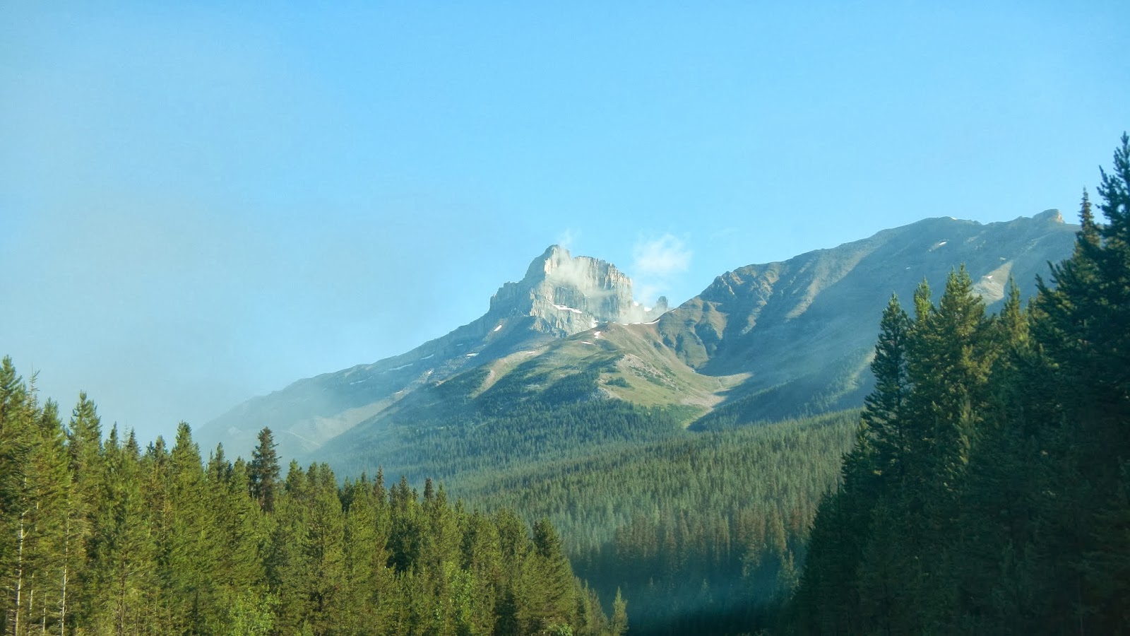
The Icefields Parkway is about 140 miles long and it was completed in 1940.  The scenery is quite spectacular along the entire route.  Mountain peaks border the Parkway on either side of the road with heights from 8,000 on up to almost 11,000 feet.  On the first segment of our drive, Mount Hector, which was actually on the east side of the road, was the tallest peak at 10,850 feet.

The Parkway parallels the Continental Divide on the left as one drives north… However, rugged mountains and ridges border both sides of the road.  Icefields Parkway travels through Banff National Park and Jasper National Park, linking Lake Louise at its south end with Jasper to the north.

The parkway is fairly busy in July and August.  According to the web, up to 100,000 vehicles use the Parkway during each of those months. The road is mostly two lanes but there aren’t many steep hills and it’s not at all curvy.  We didn’t see any wildlife along the shoulders of the road but I’m sure they represent an accident hazard.  The biggest issues are presented by tourists parked on the shoulder to take photos or pulling back out into traffic.  By our standards, traffic was minimal…

Icefields appear along the Parkway shortly after you depart Lake Louise.  Before long, you’ve passed the Wapatik, Wapta, Freshfield and Mons Icefields...all on the west side of the road.  There are also a number of smaller glaciers on both sides of the road.  

Several lakes border the Parkway…and others can be reached via auto not far off the highway.  There are at least 8 lakes along the route in just the first segment of the road.  These include Hector, Peyto, Herbert, Helen, Katherine, Bow, Chephren, Cirque, Glacier and the Waterfowl lakes. 


During one stop, Laurie captured a photo of the only wildlife that we saw during our drive… It’s a fierce Canadian Chipmunk!!

FYI… A Canadian national parks permit is required to travel on the Icefields Parkway…and the law is enforced!  The speed limit is 55 miles per hour…which is good as it allows visitors to take in the views and safely pull off and on the roadway.  The good news is that commercial trucks are prohibited!

We sure lucked out during the first portion of our drive.  However, the weather did change as we slowly moved north, taking photos and sightseeing as we went.

All of these glaciers and icefields mean water…and lots of it.  During August of course, the ice is melting and feeding the streams, rivers and lakes.  For part of the drive, we bordered headwaters of the Bow River.  Then we came upon the Howes River which fed into the North River.  All of the rivers along the first part of our drive flow east into the Saskatchewan River, and eventually into Hudson Bay.  River valleys along the road are wide and very scenic!

All along the Parkway there are plenty of sites to have a picnic, lots of hiking trails, places for camping and RV’s, and of course, a plethora of scenic viewpoints for visitors to pull off the road…

This is ‘The Crossing’.  It’s located about a third of the way along the Parkway heading north to Jasper.  It’s a resort where you can buy gas, grab a snack or a full meal, find a restroom and spend some money in the gift shop.  The Crossing is at the junction of Hwy. 93 (Icefields Parkway and Hwy. 11, which goes east to Red Deer Alberta.  Highway 11 is the only road intersecting Icefields Parkway for the Parkway’s entire length… For more, go to http://www.thecrossingresort.com/.

This is just one of the many streams flowing down from the mountains and icefields into the valley where the road is located…

There weren’t many open meadows like this along the Parkway.  It offered a nice contrast to the mountains and the forests…

By far the largest of the icefields along the Parkway is the Columbia Icefield and its associated glaciers.  For those of you who like geographical factoids, the Athabasca River and the North Saskatchewan River originate in the Columbia Icefield, as do tributary headwaters of the Columbia River.  In effect, the icefield is atop a triple Continental Divide as these rivers eventually flow north to the Arctic Ocean, east to Hudson Bay, (and then to the North Atlantic Ocean), as well as south and west to the Pacific Ocean.

What happened to the blue skies and sunshine?  Once again, the Canadian Rockies demonstrated that the weather can best be described as ‘bi-polar’… You just never know what it’s going to do next!

The Columbia Icefield lies partly in the northwestern section of Banff National Park and the southern end of Jasper National Park.  It is about 842 square miles in area and the ice is 328 to 1,197 feet deep.  The Columbia Icefield receives up to 275 inches, (roughly 23 feet), of snowfall each year.

The Columbia Icefield feeds at least 6 glaciers: Athabasca, Castleguard, Columbia, Dome, Stutfield and Saskatchewan. 
FYI…  I didn’t know this but an icefield is an area less than 19,305 square miles They consist of an extensive area of interconnected valley glaciers from which the higher peaks rise as ‘nunataks’. Icefields are larger than alpine glaciers, smaller than ice sheets and similar in area to ice caps.  From what I can determine, as compared to an icefield, a glacier is “a persistent body of dense ice exceeding a specific surface area which is constantly moving under its own gravity.

This is about as close as we got to one of the glaciers.  I’m not sure which one it was…but I believe that it was the Athabasca Glacier.  One can go on ice walks on the icefield and take rides on ‘Brewster Ice Explorers’, vehicles that are specially designed for glacial travel.  Accommodations are available near the icefield as well.  For more information, go to http://www.explorerockies.com/columbia-icefield/.

This pretty waterfall was right along the Parkway on the east side of the road… It’s called Tangle Falls.  I’ve since learned that these are the upper falls and, if one is willing and able to hike a bit, there is much more to this cascade than meets the eye.  If you’d like to see some great photos of this series of waterfalls, go to http://www.northeastwaterfalls.com/waterfall.php?num=1345&p=0. 
Also, for some great (truly professional) scenery photos of the Canadian Rockies, you can click on this link: http://www.pbase.com/deanhueber/canadianrockies.   
That’s about it for the first 80% of our drive north along the Icefields Parkway.  Just click on any of the photos to enlarge them…
Thanks for stopping by and checking out this chapter of our Canadian Rockies adventure!
Take Care, Big Daddy Dave

Wednesday, November 13, 2013

Alberta’s Moraine Lake - Plus Dinner

Here we go again…another little drive before dinner in Lake Louise Alberta Canada! 

Actually, this photo is from a day or two earlier.  This is Emerald Lake in Yoho National Park.  It was a nice photo and I’d missed it earlier… It was taken from the bridge that leads over the Emerald River to the Emerald Lake Lodge. 

To learn about this very attractive lodge and the activities offered year around, you can go to http://www.crmr.com/emerald/.

This corral of horses ready for a trail ride was photographed near Chateau Lake Louise.  Laurie loves horses so I couldn’t leave this photo out.  The Brewster family has been operating in Banff National Park for six generations…since 1892!  They offer backcountry horseback treks as well as sleigh rides in the winter.  For more information, go to http://www.brewsteradventures.com/dev08/index_trail_sleigh.html.

This is Moraine Lake, also in Banff National Park.  This is yet another glacially-fed lake.  It’s about 9 miles south of the Village of Lake Louise.  Moraine Lake is in the ‘Valley of the Ten Peaks’, and it sits at an elevation of 6,183 feet. 

The short Rockpile Trail is the trail most commonly followed by tourists. It follows along the actual moraine, it’s a not much more than 300 yards long with an elevation change of 79 feet.  The view of the lake from the top of the rockpile is one of the most photographed locations in all of Canada.  That view of the mountains behind the lake in Valley of the Ten Peaks is known as the “Twenty Dollar View”, as Moraine Lake was featured on the reverse side of the 1969 and 1979 issues of the Canadian twenty dollar bill. 
Views of Moraine Lake have also impacted our current technological world… They have been used on Google Android, the Blackberry Pearl, Windows 7 and by Bing on their homepage.

This is the Moraine Lake Lodge on the shores of the lake.  I have to tell you that the drive from Lake Louise to the lake and lodge is very popular!  Parking is limited and the road is narrow.  Where the road to Moraine Lake departs Lake Louise, we were turned away 2 or 3 times before we were allowed to make the drive…and by then the weather had changed and it was drizzling a bit.  The parking lot was still jammed with tourist’s vehicles.
From what I saw on the Moraine Lake Lodge website, this is definitely an upscale place to stay and to dine… To learn more and to check out some great photos from the area and the lodge, go to http://morainelake.com/.

Well, it was getting late and it was time for dinner.  We decided to check out the Post Hotel and Spa in lower village at Lake Louise.  As with the Chateau Lake Louise, the Post Hotel has been awarded 4-Diamonds by the American Automobile Club.  Its 96 rooms are priced range from $275.00 to $715.00 per night… To learn more about the Post Hotel and Spa, just go to http://www.posthotel.com/posthotel/index.html.

We checked out the hotel a little bit…and it has a very luxurious warm and woodsy feel to it.  I quickly determined that the continental dining offered in the 4-Diamond Post Hotel Dining Room was a little out of our price range…

Then as we drove around the property, I found the restaurant I was looking for!  This is the Outpost Pub at the Post Hotel.  I’d ‘discovered’ it through my research on Trip Advisor.  At the time I did my research, it was considered one of the more reasonably priced places in Lake Louise, at least among those that had a solid rating.  It achieved my standard of no worse than 10 positive reviews for each negative review. 

After Laurie’s glass of Cabernet ($7.00) and my bottle of Canadian beer ($6.50), we ordered our dinner.  Laurie went with the pasta of the day…roasted veggies with prime beef over spaghetti noodles in a light broth or sauce. ($19.50) She thought that it was pretty good…

I decided that I’d just go with a Club Sandwich and French Fries. ($16.00) It was a very good but pricy club sandwich and the fries were better than average. 
Usually we’d share a photo or two showing the décor of the Outpost Pub, but all of our inside photos were blurred for some reason…and I couldn’t find a photo on line anywhere.  I did note that many diners where stuck on couches with low ‘coffee tables’…not too comfortable for eating dinner.  Overall, the food was good if not outstanding and service was just mediocre.
Just click on any of the photos to enlarge them…
Thanks for stopping by for a visit!
Take Care, Big Daddy Dave