Showing posts with label New Zealand. Show all posts

Friday, April 26, 2013

Great Trips – New Zealand/Final Chapter

For those of you that have followed us on this trip, this is Chapter XII, the last segment/blog about our 2000 New Zealand travel adventure.  Just in case you haven’t picked up on it, we loved this trip!  The scenic beauty, combined with a minimum number of very nice people, with plenty of available amenities, equaled a great travel experience…


This is a view of the interior of the Otago Peninsula near Dunedin.  Yes…just in case you noticed all of those little white dots…those are sheep…lots of sheep!  The Otago Peninsula is one side of an extinct volcano, encompassing Otago Harbor.  One small part of the peninsula consists of part of Dunedin’s suburbs and there are a few small scenic settlements around the shore line.  Only 10,000 people live here…and most of them live close to the city, and much of the land is given up to pastoral beauty such as seen above…

This is a satellite view of Dunedin, the Otago Peninsula and Otago Harbor.  The city circles around the base of the harbor and the landside end of the peninsula.  The highest point on the peninsula is about 1,339 feet.  At one point along the shoreline, sand dunes reach up to about 330 feet high.  This striking peninsula is home to a fort, old homes, Larnach Castle and the Royal Albatross Center.  For more on what to see and do, go to http://www.dunedinnz.com/visit/see-and-do/tag/Otago-Peninsula.aspx.


An architect named George Troup, aka ‘Gingerbread George’ designed the Dunedin Railway Station beginning in 1903, completing it in 1906.  The renaissance revival architecture was employed using dark basalt, light colored but dense Oamaru limestone, with pink granite columns and terra cotta shingles or tiles from France. 
The clock tower is roughly 121 feet tall.  The railway platform along the tracks stretches for 1,640 feet…or more than a quarter of a mile!  This is actually the 4th station serving Dunedin.

Believe it or not, these are the ticket windows in the ‘booking hall’ of the Depot.  Spectacular!  For those of you that are collectors, the frieze of Royal Doulton porcelain stretches entirely around the wall and balcony in this hall…   

This is the tile medallion decorating the center of the ticket or booking hall.  Almost 750,000 Minton tiles were used to cover and decorate this space.  Back in the days when Dunedin was ‘the happening place’ on the South Island, over 100 trains per day came through this depot. 
Today, only the Taieri Gorge Railroad’s daily passenger tourist trains arrive and depart from the Dunedin Depot.  I wish that we’d had the time to take this tour… For more on this spectacular train ride, including some great photos, go to http://www.taieri.co.nz/index.htm.

This is another spectacular building in Dunedin.  Believe it or not, it’s the old Dunedin Jail.  This Victorian courtyard prison was built in 1896 and it wasn’t decommissioned until June of 2009, after 115 years of operation.  Fund drives are under way to raise $2.6 million (NZ) to allow the Dunedin Charitable Trust to remodel and repurpose the interior of the structure.  Currently, guided tours are being given by prison trustees who’ve lived there as well as guard guides.  Cost is only $10.00!

This is a postcard view of our favorite city in all of the South Island.  This is Oamaru.  Perhaps it was the stunning architecture, the wide streets, the covered sidewalks, the laid back atmosphere, the nice people…or all of those things that caught our fancy. 
In this postcard, you can see what the downtown shopping district looked like back in 2000. (Remember…there weren’t any US style malls) Also visible is the old post office dating from 1883 with its 92 foot high clock tower, (added in 1903), St. Luke’s Anglican Church (1866) and, off in the center right, Columbia Presbyterian Church (1883).  

As you probably noticed from the postcard photo, many if not most of the buildings were built in the style shown above…and all of them were built from local Oamaru Limestone, a very dense and strong form of that type of stone. 
The building shown above is the Criterion Hotel and Bar.  It was built in 1877, later was a temperance hotel, closed, opened as a boarding house, then it was used as a warehouse with a confectionary and soft drinks shop… In 2012, it was purchased and renovated, reopening as a hotel and bar.  For information, just go to http://www.criterionhotel.co.nz/.  Oamaru is a visual delight…

Laurie of course took this and almost all of the other photos from this trip.  I do believe that I know that tourist who’s walking down the covered sidewalk in downtown Oamaru!  This town especially…and to be honest…most of the South Island of New Zealand felt like we’d stepped back to a gentler, kinder place in time.
For more about Oamaru, its sights and attractions…plus photos, you can go to: http://www.markstravelnotes.com/oceania/new_zealand/otago/oamaru/.

I actually took this photo!!  This is Laurie at the Christchurch airport with our loaded luggage cart after unpacking our rental car.  We put some miles on that car!   I know one thing for sure… In today’s world, taking that much luggage on a trip would cost hundreds of extra dollars! 
 
And…finally…here’s our plane coming in to pick us up.  From here we flew to Auckland where we changed planes and flew directly to Los Angeles and then to Chicago.  We loved Air New Zealand!  The people were very nice and they really acted like they cared about their passengers.  Of course, thanks to frequent flyer miles, it didn’t hurt that we were first class passengers to Auckland and we flew business class back to Los Angeles…
For information regarding flights and fares on Air New Zealand, you can link up at http://www.airnewzealand.com/.
Thanks for tagging along on this 12 chapter photo travelogue!  We had a great time on this trip and I hope that you found it interesting and informative.  I think that the photos spoke for themselves… Visit New Zealand!!
Just click on any of the photos to enlarge them…
Take Care, Big Daddy Dave

Friday, April 19, 2013

Great Trips – New Zealand #11

Continuing with our New Zealand adventure… Leaving Invercargill and Bluff behind, Laurie and I continued our drive along the South Island’s Scenic Southern Route toward the city of Dunedin. (The route stretches from Queenstown to Dunedin)

As was usual on this trip, the scenery didn’t disappoint us! 

This is the Nugget Point Lighthouse.  It was built back in 1870 using locally quarried stone.  In the early days the light was fueled with oil.  Today it’s fully electrified…but the original 1870 lens for the light is still in use!
Incidentally, the walk along the path in the photo to the lighthouse provides many different views of the ocean and the coastline…

I particularly liked this photo.  The play of the sea, waves, rocks and the colors just kind of works!  Nugget Point is one of the most notable landforms along the southeastern coast of the South Island of New Zealand. 

This is why they call it Nugget Point… These are the ‘nuggets’ or rocky islets just beyond the lighthouse.  The area is home to penguins, gannets, spoonbills and a breeding colony of Southern or New Zealand Fur Seals.

These are the Matai Falls… While they’re only about 33 feet high, they are just one of several beautiful waterfalls in the South Island’s ‘Catlins’ region.  The tallest waterfalls in The Catlins are the McLean Falls at about 72 feet. 
The Catlins or, as it’s sometimes called, the Catlins Coast is a rugged, sparsely populated area in the southeast corner of the South Island.  It has scenic coastal landscapes combined with dense temperate rainforests. (About 150 inches of rain falls in The Catlins each year) The highest peak in this area of about 730 square miles is 2,360 feet.  One of the area’s charms is the fact that only about 1,200 people live here…or a little more than 1.5 persons per square mile.

This is St. Paul’s Cathedral in Dunedin on the South Island.  It is the ‘mother church’ for the Anglican Diocese of Dunedin and the home church for the Bishop.  The cathedral is located near the heart of the city.  It was first planned for in 1895…but the first foundation stone wasn’t set until 1915 and it wasn’t consecrated until 1919.

This photo from Wikipedia shows how Dunedin surrounds the head of Otago Harbor.  The harbor and the hills are remnants of an extinct volcano.  This 2nd largest city on the South Island was first settled in 1848 and it’s now home for about 127,000 New Zealanders. 
The city is also the home of the University of Otago with its 21,000 students.  The university was founded in 1871 and it was the first university in New Zealand.  The town definitely had a student ‘vibe’ to it and so did the cuisine…some of the best we had during our trip.

This is New Zealand’s only ‘castle’… The Larnach Castle is located on the Otago Peninsula not far from Dunedin.  Construction started in 1871…and was completed in 1886.  William James Mudie Larnach, a wealthy merchant baron and politician built it for his 1st wife.  It took 200 workmen 3 years to build the structure and it took a group of European master craftsmen another 12 years to finish the interior. (Sounds like a Chicago highway construction project!) The ‘castle’ has 43 rooms and a ballroom.
Unfortunately, Mr. Larnach was predeceased by his 1st wife, his 2nd wife and his favorite daughter…for whom he’d built the ball room adjoining the ‘castle’.  He committed suicide in New Zealand’s Parliament Building in 1888…only one year after the death of his daughter and 2 years after completion of this impressive structure!  The castle is allegedly haunted by Mr. Larnach’s 1st wife as well as by his daughter and it’s been featured on the TV Show, “Ghost Hunters International”.

This is a view from the castle…looking down on the ballroom he added to the property as well as part of Larnach Castle’s gardens.  The gardens are only 1 of the 5 in New Zealand that have been rated as a ‘Garden of International Significance”.

The Royal Albatross Centre and Colony is also located on the Otago Peninsula at Taiaroa Head.  This is the only mainland breeding colony for any species of albatross in the Southern Hemisphere.  The population of this colony is about 140 birds.  They have successfully hatched over 500 chicks since the Centre was established in the 1930’s.  Other exotic seabirds are also resident here…including over 3,000 Red Billed Gulls.

The Southern Royal Albatross with the Northern Royal Albatross are the largest seabirds in the world.  They have a wingspan of up to 10 feet 10 inches.  These birds spend 85% of their life at sea and they travel as much as 118,000 miles each year.

Here’s one more photo of a New Zealand or Southern Fur Seal.  We found them all along the coast…especially beginning at Nugget Point and stretching back up to the Otago Peninsula.  I know that they bite…but I think that they are probably the most attractive seals we’ve ever seen…
That’s about it for this edition of our 2000 New Zealand Trip…only one or two more chapters before I complete this saga!
Just click on any of the photos to enlarge them…
Thanks for stopping by and viewing my ongoing travelogue!
Take Care, Big Daddy Dave

Monday, April 8, 2013

Great Trips – New Zealand X

We’re only 3 or so blogs from the end of our 2000 great trip to the South Island of New Zealand… In this edition of our saga, the sun was out and the photos were especially sharp!

 
Before we left Lake Te Anau, I once again followed one of the ‘traditions’ of the Myers men.  We love to dam up, channelize or divert streams of water or even lakes!  This creek empties into Lake Te Anau just across from the bed and breakfast that we stayed in.  I decided that a rudimentary dam and rapids were in order…

I’m actually the first person, at about the age of 12, who connected Little Lake in Michigan’s Upper Peninsula with Lake Superior…just by digging a little channel between the two.  By the morning after, my channel was a raging torrent and it had lowered the level of Little Lake.  At some later date the US Coast Guard apparently recognized my forward thinking and Little Lake is now a designated safe harbor on Lake Superior.
 
This is a view of the Mataura River Valley along Route 6, on the South Island.  We were driving south toward Invercargill.  Beautiful scenery with no people, no traffic, almost no pollution and no stress!
 
 
This is a view of Foveaux Strait near the town of Riverton, New Zealand.  The strait separates the South Island from the much smaller Stewart Island to the south.  Stewart Island has a total population of about 400 people…

Foveaux Strait is noted for its dangerous waters… From 1998 through 2012, 23 people lost their lives in the strait. 
 
Laurie took this photo of these bright and colorful flowers at a home in the town of Riverton New Zealand.  Riverton, which is also known as Aparima, has a population of about 1,900. 
 
The town was founded in 1837 and its one of the oldest towns in all of New Zealand.  Riverton lies on the South Island’s Southern Scenic Route and it’s very popular with tourists due to the fact that its beaches are safe for swimming and it has a protected harbor. 
 
 
This is the Beachhouse Café Bar in Riverton NZ.  We stopped by and had a nice lunch…but the view from the restaurant was even better.  It’s right across the street from the ocean! 
 

I checked and found that this restaurant is still in operation.  For more information, you can go to this site on Trip Advisor: http://www.tripadvisor.com/Restaurant_Review-g670372-d722044-Reviews-Beachhouse_Cafe_Bar-Riverton_South_Island.html.  A total of 33 reviewers gave Beachhouse Café Bar a “Very Good” or “Excellent” rating.  I noted that the prices ranged from $17.00 t0 $32.00 US.  I’m sure glad that the NZ dollar was at 49 cents to the US dollar when we were there!  
 
Another helpful traveler took this photo of Laurie and me at the southern tip of the South Island of New Zealand in the town and port of Bluff.  If you headed south from here, the next land that you’d encounter would be Antarctica!

Bluff has a population of around 2,000.  It is a seaport that’s located about 19 miles from the larger city of Invercargill.  Bluff’s harbor is the terminus for twice daily catamarans to Oban on Stewart Island…about 10 or 11 miles south.  An oyster fleet is also based in Bluff and this port is the main gateway for New Zealand ships that are headed to the South Atlantic Ocean.
 
Here’s a close-up of the sign at Stirling Point, the southern tip of the South Island… Just think, it is ‘only’ 2,989 miles to the South Pole and ‘just’ 9,326 to New York City from here!
 
 
This is another view of the far South Pacific from along the highway near Bluff.  It was a beautiful day for driving and sightseeing!
 
 
Since I like taking big ship photos, I’m ending this chapter of our New Zealand trip with this photo of the "TNT Alltrans", an Australian registered bulk carrier, as it entered the Bluff Harbor with a load of alumina for the nearby aluminum smelter.  The first ship to enter this harbor did so in 1813.

A little research revealed that this ship transferred to new owners in 2008 and it was renamed “Star Carrier”.  This 620 foot long ship gained a bit of notoriety in 1985 when it ran aground on Lady Musgrove Island in Australia’s Great Barrier Reef.  Fortunately, relatively little damage was done to the reef.  The officer on duty had fallen asleep after drinking…
Just click on any of the photos to enlarge them…
Thanks for stopping by and vicariously sharing our New Zealand adventure with us!
Take Care, Big Daddy Dave

Wednesday, March 27, 2013

Great Trips – New Zealand IX

One of the highpoints of our New Zealand trip…or adventure…was our visit to Milford Sound.  Milford Sound is a fjord in the southwest corner of the South Island.  It lies within Fiordland National Park, the Piopiotahi Marine Reserve and the Te Wahipounamu World Heritage Site.  Following an international survey, it was listed as one of the world’s top travel destinations by Trip Advisor.  Milford Sound is New Zealand’s most famous tourist destination.  Rudyard Kipling had called it the Eighth Wonder of the World!

 
The first challenge is to get to Milford Sound.  Unless you own a large yacht, you have 2 choices… You can drive the 76 miles from Te Anau in a rented car or you can take a tour bus.  This photo from Wikipedia shows the inside of the Homer Tunnel which leads down to Milford Sound from the mountains.

This is the scariest tunnel we’ve ever driven through.  It’s narrow, it’s damp and the walls are unlined granite.  The ¾ mile long tunnel was started in 1935 and it wasn’t completed until 1954…with time off for WWII.  Two RV’s or two busses going in opposite directions cannot pass each other… There are stoplights at each end of the tunnel that operate in the summer but having vehicles line up at the eastern portal in the winter and spring is too dangerous…due to avalanches.
Since we traversed the Homer Tunnel, they’ve added lights on the ceiling, a satellite phone and fire extinguishers.  When a bus caught fire in the tunnel with no lights for the tourists to guide them on their walk to safety, these improvements were deemed prudent.
 
I almost forgot!  There is one other travel option if you want to go to Milford Sound… Another photo from Wikipedia shows the 2,565 foot long runway at the Milford Sound Airport.  That would be one heck of a landing and takeoff…not to mention the flight over the mountains!
 
 
This is the ‘Milford Wanderer’.  The brochure at the time of our visit referred to this vessel as a sailing scow…but my research doesn’t confirm this designation.  This is a sail assisted motorized ship with a fairly flat bottom…  We choose this over the other options in Milford Sound, and there were several, because it was slower, took longer and it had sails.  It reminded us of another time and place…much like Milford Sound. 

From what I could gather from the website, RealJourneys now uses the ‘Wanderer’ and a similar ship, the ‘Mariner’, for overnight adventures.  Rates start at $189.00 per adult.  For more information, you can just go to https://www.realjourneys.co.nz/en/experiences/cruises/milford-wanderer-overnight-cruises/.  The same website offers other cruising options on faster and more modern boats as well.  A 1 hour and 40 minute scenic cruise starts at $70.00 for an adult.
 
For perspective, here's another photo ‘borrowed’ from Wikipedia… This shows the head of Milford Sound with the town, airport and the junction of the Cheddau and Arthur Rivers.  The population of Milford Sound is about 120.  The small port area to the right of the waterfalls at the left side of the photo is where all of the cruises begin and end… The scenery speaks for itself!
 
 
Visiting Milford Sound would be exciting and amazing at any time…but good timing and luck can contribute to one’s enjoyment of the place.  Here’s the conundrum… If it’s all blue skies and there hasn’t been any rain recently, there are only 2 permanent waterfalls falling down the side of the fiord.  If it’s cloudy and raining, there are literally hundreds of waterfalls falling down the cliffs.  We were very lucky… It was both cloudy and sunny and there had been plenty of rain! 

The mountain at the center of the photo is Mitre Peak…so named for its resemblance to the head ware of Christian Bishops.  Mitre Peak is 5,151 feet above the fiord below.
 
This is just one of the many many waterfalls that we saw during our excursion on the Milford Wanderer… They ranged from those that fell from the cliffs but just blew away in the mist before hitting the fiord to some very impressive waterfalls such as Stirling Falls, (508 feet), and Lady Bowen Falls, (531 feet)…the two permanent falls along the fiord. 
 
 
Here’s another view of the water coming off the cliffs along the sides of Milford Sound.  The mean annual rainfall at Milford Sound is 268 inches or…22 feet 3 inches!  A total of 10 inches of rain in a single day is not uncommon.  The town is the wettest inhabited place in New Zealand and one of the wettest in the world…
 
 
Laurie took this photo of a sea cave along the fiord…

FYI… Milford Sound is 9.3 miles long…stretching from the town to the open sea.  The sound or fiord is lined by sheer rock faces on either side that exceed 3,900 feet.  In addition to Mitre Peak, other notables mountains along was include ‘The Elephant’ at 4,977 feet and ‘The Lion’ at 4,272 feet.
 
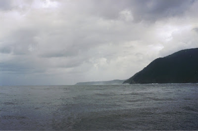
This is the view from the mouth of Milford Sound… You are looking west across the Tasman Sea toward Australia.  The Tasman Sea is about 1,200 miles wide.  If you were to look at a map, Milford Sound’s closest city in Australia is Hobart, the capital of Tasmania… Milford Sound is actually more southerly than Hobart.  It was windy and blustery as we entered the open sea. 
 
 
This was a great tour up the fiord!  No rushing, very few ‘bus tourists’ due to the length of the cruise, laid back passengers, sails raised near the Tasman Sea… Plus we had a nice mix of clouds, drizzle/light rain and sunshine.  Laurie actually joined the crew to help them raise the sails!
 
 
This is Stirling Falls…one of the 2 permanent waterfalls mentioned earlier.  The captain of the ‘Milford Wanderer’ gently slid the bow of the ship under the front edge of the waterfall.  The passengers loved it! (Photo borrowed from the RealJourneys website)
In various places the cliffs and mountains along the sides of Milford Sound alternated bright green with vegetation versus rock slopes stripped bare.  The vast amounts of rain soften the soil and moss’s hold on the cliffs and avalanches periodically strip segments of the slopes of all vegetation. 
 
Lucky tourists can view penguins, dolphins, fur seals and occasional whales while cruising on Milford Sound.  We did see quite a few New Zealand Fur Seals basking on the many giant rocks along the shore of the sound.  Technically, they are Australian Fur Seals…but in Australia they’re referred to as Southern Fur Seals.

Although they were once hunted and endangered, these animals are no longer listed as a threatened or endangered species.  The average female weighs between 66 and 110 pounds and they measure 5 feet long.  A typical male weighs around 277 pounds and they’re about 6.5 feet long.  Males as large as 550 pounds have been reported.  These seals are great divers…with the females able to dive over 1,000 feet and stay down for 9 minutes…and the males able to stay down for 15 minutes and reach depths of almost 1,250 feet.  That’s close to a quarter mile under water! 
 
Yes… I did lift this photo from Wikipedia… This is one last look at Milford Sound on an almost perfectly sunny day.  Spectacular!!  Be sure and enlarge this photo...
 
 
After a great day on Milford Sound, we drove back up NZ Route 94 for our second night at Te Anau.  I do believe that I forgot to mention that this drive has been rated as one of the most photographic drives in the world.  We’re sure glad that we didn’t take a bus!

In the next edition, we’ll be headed south…to Invercargill and the edge of civilization.
Just click on any of these photos to enlarge them…
Thanks for stopping by and sharing another segment of our New Zealand adventure with us!
Take Care, Big Daddy Dave

Monday, March 18, 2013

Great Trips – New Zealand VIII

Continuing south from Kingston and Lake Wakatipu, we ventured further into New Zealand’s South Island Lake Country.  There are at least 9 major lakes in the Otago, Fiordland and Southland areas of the island.  One of them, Lake Hauroko is 1,519 feet deep.  In the USA, only Crater Lake and Lake Tahoe are deeper.

 
While we saw a plethora of sheep farms and a number of deer farms, this was the only elk farm that we came across. 

As in the USA, New Zealanders introduced many exotic animals over the years, many for hunting purposes.  New Zealand’s only native mammals are bats.  There are literally thousands of deer farms, mostly red deer, throughout the country.  Elk farms are much less numerous.
Because of their unique native flora and fauna, New Zealand has few hunting restrictions re: season or bag limits.  This effort to protect native plants and animals seems a bit too late…but hunting is now very popular.  In addition to Red Deer and Elk, (Wapiti), those so inclined can hunt Fallow Deer, Rusa Deer, Sambar, Sika Deer, Whitetails, wild pigs and Tahr…a Himalayan import related to wild goats.  
 
Along the road to our destination for the evening, we came across this cruise boat on Lake Manapouri.  We wanted to experience one of the fiord cruises and this was one of our options.  The Doubtful Sound cruise sounded great but we had a timing issue so we passed up this option for the one we’ll share with you on our next New Zealand blog.  We wish we’d had time to take both cruises…

The Doubtful Sound cruise begins with a ride across Lake Manapouri…another of the big lakes on the South Island.  Then you board a bus lakeside, (elevation 583 feet), and cross over the Wilmot Pass, (elevation 2,201 feet), and then descend to Doubtful Sound.  Based on the photos, the view of the sound from the pass is very impressive.  For information on Doubtful Sound cruises, just go to https://www.realjourneys.co.nz/en/destinations/doubtful-sound/.
 
This is the view of Lake Te Anau from our Bed and Breakfast in the town of Te Anau.  This lake is the 2nd largest on the South Island at 133 square miles.

Te Anau, (the town), has a fixed population of around 2,000 and it’s on the east shore of the lake...with the mountains across the lake.  In season, the town’s head count can swell to 5,000 on any given night.  Of note is the nearby Te Anau Wildlife Center where bird lovers can view the Takahe…a very rare flightless bird. (http://en.wikipedia.org/wiki/Takah%C4%93) We did see it but our photos don’t show much as it stays in high grass in its enclosure.  
 
This was our Bed and Breakfast in Te Anau…The Cats Whiskers.  Our accommodations were very nice and they served us the closest thing to an American breakfast that we had on the entire trip.  Current rates appear to range between $115 NZ to $180 NZ.  That converts to $95 US to $150 US.  For more information, you can go to http://www.catswhiskers.co.nz/contact___links.html. 
 
 
You might ask…Why is this Bed and Breakfast named the Cat’s Whiskers?  Well, if you don’t like cats, this inn won’t be your cup of tea!  As we were unloading our rental car, this cat decided to make herself home in the back window of the car.  She didn’t really want to leave either… There were several other cats on premises, although not in the inn itself.  As it happens, we like cats so this encounter was a little treat for us…
 
 
One big attraction at Te Anau is the limestone caverns on the other side of the lake.  The photo above is of the stream flowing from the caves into the lake.  You can see the tour boat beyond that took us across the lake.  The caves closest to the lake contain a glowworm colony.  Part of the experience is being poled on a punt or flat bottom boat through the cave with the glow worms doing their thing on the cave’s ceiling above you.  It was interesting and it is a popular tour.  The adult tour rate is $75 NZ or roughly $62 US.  For more information, go to https://www.realjourneys.co.nz/en/experiences/glowworm-caves/te-anau-glowworm-caves/.  I’d show you a photo of the cave but they just didn’t come out…
 
 
This is actual proof that we were both on this adventure!  Some nice tourist offered to take our photo… On this tour, Laurie and I met the only people we’ve ever come across from New Caledonia in the South Pacific.  We also met a number of young men and women, often traveling alone or in pairs, who were off on a post collegiate exploration of the rest of the world.  Sadly, we didn’t encounter more than one or two young Americans on one of these adventures…
 
 
One more photo of Lake Te Anau… Te Anau is the starting point for 2 of New Zealand’s famous walks, hikes or treks.  New Zealanders refer to this as ‘tramping’… The Milford Track, (33 miles, 3 – 4 days), and the Kepler Track, (37 miles, 3 -4 days), begin here… So does the 76 mile road to Milford Sound, our next destination!

If you're into hiking, for additional information on the Milford Track, just go to http://en.wikipedia.org/wiki/Milford_Track.  For the Kepler Track, check it out at http://en.wikipedia.org/wiki/Kepler_Track.
Just click on any of the photos to enlarge them…
Thanks for stopping by for another glimpse of a portion of our New Zealand adventure!
Take Care, Big Daddy Dave